As we are taking stock of this year’s deadly wildfires, some worrying trends emerge. 41% of areas burnt in the EU this year – a total of 192,851 hectares – are within the EU biodiversity reservoir of Natura 2000, according to the European Forest Fire Information System (EFFIS).
The wildfires this year emitted some 20 million tonnes of carbon dioxide into the atmosphere, which is already above the EU average for 2003-2022 and the fire season is not over yet. The greenhouse gases that were released will further intensify climate change.
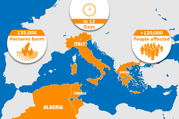
Even though the total burnt area in the EU from the beginning of this year up to now is significantly below the 748 426 hectares burnt in 2022, amounting to 468 289 hectares, wildfires this summer had an exceptional impact in terms of how they affected tourist areas, hitting local economies hard. The Canary Isles, the Greek islands such as Rhodes, as well as Sicily and the Algarve were all ravaged by fires.
An intense fire season in the Mediterranean
The situation in some Mediterranean countries has been dire in the wildfire season, which is still ongoing. Destructive fires hit Spain early in the season, and in July broke out in Greece, Italy, Spain, and Portugal. August was a tipping point for the fires in Greece, which suffered the most devastating fire that ever occurred in the EU.
After the destructive blazes on the islands of Rhodes and Corfu and in the Athens area in July, dozens of new wildfires broke out across the country in August. The most severe one was located in its northeast region, near the city of Alexandropoulis, on the border with Türkiye. The fire started on 19 August and burned for several days, aided by conditions such as dry vegetation on the ground, strong winds and high temperatures. EFFIS estimates that over 94 000 hectares of natural land were burnt in this single blaze.
Over 45 000 hectares of forests went into flames in Greece, and 62 000 hectares burnt within one of the Natura 2000 biodiversity reservoirs there, including the Dadia-Lefkimi-Soufli Forest National Park.

Copernicus Emergency Management Service monitoring and rapid mapping
The Copernicus Emergency Management Service (CEMS) continuously monitored the impact of fires in the Mediterranean region. The CEMS European Forest Fire Information System (EFFIS) recorded up to 1273 fires above 30 hectares in the EU by the end of August. In addition to the monitoring of wildfires in EFFIS, the CEMS on-demand mapping was activated for the detailed mapping of 22 individual fires in several countries.
The CEMS provides crucial information to civil authorities and humanitarian efforts to prepare for critical events and for its monitoring and evaluation through its three components. EFFIS, the wildfire early warning and monitoring system of CEMS, for example, continuously forecasts and monitors forest fires in the European, Middle Eastern and North African regions.
In addition to this, the on-demand mapping service produces additional detailed geomaps of the events monitored in CEMS upon activations requested by or through authorised users, which are usually the civil protection mechanisms in each country. In addition, with the exposure mapping it is possible to estimate the potential affected population, buildings and infrastructure through the Global Human Settlement Layer.
The EU response
Following Greece’s request for assistance on 20 August, the EU’s Emergency Response Coordination Centre responded with the biggest rescEU aerial firefighting operation, mobilising 11 airplanes and 1 helicopter in addition to the 5 planes from the Greek rescEU fleet that are also operating in response to the fires. Via the EU Civil Protection Mechanism, more than 407 first responders and 62 vehicles helped the country.
This assistance follows the EU’s prompt reaction to Greece’s earlier activation of the EU Civil Protection Mechanism. Last month, a coordinated deployment involving 9 planes, 510 firefighters, and 117 vehicles was launched to tackle the escalating wildfires.
O artigo foi publicado originalmente em JRC.


